Weather live updates: Flights cancelled and roofs lifted as gale-force winds hit Taranaki and Wellington
Low-pressure system pushing rain and southerly winds up over the centre of NZ
Vera Alves
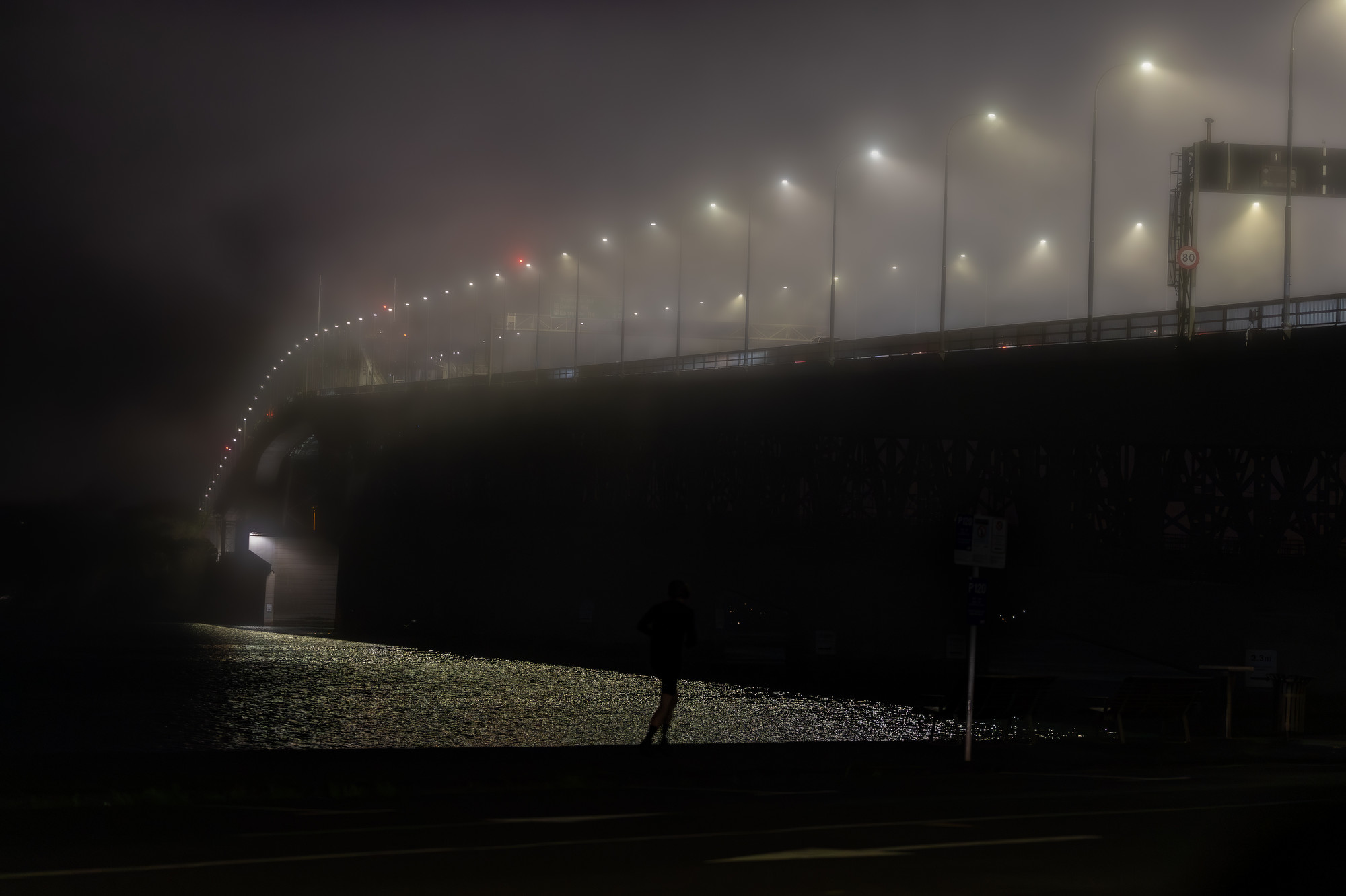
Wellington is copping the worst of today's weather with wind speeds at the capital's airport currently sitting at about 90km/h, MetService's head of weather news Heather Keats says.
"Overnight and in the early hours of this morning, places like Mount Kaukau, which is quite exposed and quite elevated, they've been having gusts of over 150km/h," Keats told Ryan Bridge TODAY.
"They're having maximum wave heights at Baring Head in Wellington Harbour of over 8 metres."
Keats said a low-pressure system is sitting to the northeast of the North Island and pushing rain and strong southerly winds up over the centre of the country, with most weather warnings and watches expected to expire later today.
"The areas of concern are actually the heavy rain warning, which is an orange warning for the Tararua Range, Wairarapa, south of Masterton and Wellington.
"That's going to end at midnight tonight. So the winds will start to kind of die down later on today, but they're still going to have some heavy rain there.
"Strong wind warnings also in place too for Taranaki. Lots of other watches and warnings scattered around, but we're expecting snow again for higher spots of North Canterbury and Marlborough, so road snowfall warnings still in place too for Lewis and Porters Pass."
Vera Alves
Swells in the Cook Strait are getting larger, with a buoy at Baring Head measuring a wave of 6.73m this morning.
Wind gusts exceed 100km/h across North Island, Cook Strait
Vera Alves
MetService is warning the strongest wind gusts aren't expected to hit central New Zealand until later this morning, as it records extremely fast wind speeds reaching 154km/h overnight.
The top speed, recorded in the 12 hours before 6am, was at Wellington's Mt Kaukau, with 151km/h wind gusts also seen on Brothers Island in the Cook Strait.
Other significant wind gusts observed over this period were in Northland's Cape Reinga (133km/h), New Plymouth Airport (117km/h) and Wellington's Kelburn (110km/h).
Long queues forming at Auckland Airport
Vera Alves
Long queues are forming as people try to make other plans. Some passengers on early flights are now due to travel this evening but are being warned those services may also be disrupted.
Snow and ice close roads in South Island
Vera Alves
In the South Island at least two state highways are closed due to snow and ice.
The NZ Transport Agency said SH8 between Lake Tekapo and Twizel was now closed and Porters Pass was also inaccessible due to snow.
Passengers scrambling to rebook flights, risk missing important events
Vera Alves
Passengers are scrambling to rebook flights to Wellington as wild winds disrupt airlines. One man was due to attend his father's funeral this morning in the capital and one rebooking option would see him miss the service.
Strongest gusts won't peak until later this morning
Vera Alves
The strongest wind hasn't hit yet, MetService is warning, after southerly gales buffeted the country overnight.
Wind gusts wouldn't peak in the centre of New Zealand until later this morning, the forecaster said.
As of 6am Mt Kaukau in Wellington had measured a 154km/hr gust, while Brothers Island had measured 151km/hr and Cape Reinga had seen a 133km/hr gust.
New Plymouth Airport measured a gust of 117km/hr and Kelburn in Wellington had seen 110km/hr.
"Take care if you're out and about. Conditions will start to ease later this afternoon and into this evening."
Fallen trees close State Highway 3 amid gale-force winds
Stephen Marr
Fallen trees have twice closed State Highway 3 this morning as gale-force winds hit Taranaki.
Currently drivers are being detoured through the town of Waitara after a fallen tree blocked SH3, the NZ Transport Agency's website said.
Fallen trees also closed a section of SH3 through New Plymouth earlier this morning but the road has since reopened.
The city was recording 75km/h gales around 6am, with gusts hitting 114km/h, according to MetService.
15 weather warnings across lower North Island
Stephen Marr
There are presently 15 weather alerts currently in force across New Zealand, the bulk centred on the lower North Island.
An 18-hour heavy rain warning started at 6am for Wellington. The region is also partway through a strong wind warning which came into effect at 9pm and will not lift until 6pm.
There is also a strong wind warning for Taranaki with severe gales across the day while the rest of the lower North Island is also expected to be buffeted by strong winds.
Stephen Marr
Flights affected well into the afternoon
Stephen Marr
Most flights scheduled to depart or arrive in Wellington this morning have been cancelled, as gusts up to 100km/h are recorded at the capital's airport.
Wellington Airport's arrivals and departures board show there have been a number of disruptions to airline services throughout Friday morning and into the afternoon.
As of 7am, a number of Wellington-bound flights have been cancelled before 12.45pm, including seven from Auckland, four from Christchurch, two from New Plymouth and two from Hamilton.
Specific services - each departing Nelson, Tauranga, Gisborne, Napier, Blenheim, Rotorua, Queenstown and Timaru respectively - have also been grounded.
Six Auckland-bound and six Christchurch-bound flights have also been scrapped, along with a dozen services to Rotorua, Blenheim, Nelson, Tauranga, Dunedin, New Plymouth, Gisborne, Hamilton, Napier, Queenstown and the Chatham Islands.
Luckily for some, Air New Zealand flight NZ254 to Melbourne and Qantas flight QF162 to Sydney were both able to depart shortly after 6am, while Sounds Air flight S8260 arrived in Wellington from Blenheim about half an hour later.
Truck driver trapped by fallen tree
Stephen Marr
A driver was trapped in a truck cab this morning after hitting a tree in New Plymouth.
A Fire and Emergency spokesman said the person had been extricated by fire crews and handed over to the ambulance service.
It was unclear if the tree had already been brought down by strong winds when it was hit by the truck.
Flights cancelled into or out of Wellington
Stephen Marr
Air New Zealand has cancelled flights in Wellington this morning due to the severe weather conditions.
Chief Operations Officer Kate Boyer said: "Strong winds are impacting Wellington this morning, with gusts exceeding 50 knots. As a result, we have cancelled a number of domestic flights in and out of Wellington.
"Our teams are closely monitoring the conditions and will only operate flights when it is safe to do so.
"Since yesterday, we have been offering added flexibility for customers travelling to or from Wellington, allowing them to proactively change their flights free of charge.
"Customers travelling today are encouraged to check the Air New Zealand app or website for the latest information on their flight."
Power outages strike Wellington
Stephen Marr
Nearly 300 homes in Wellington have also been hit by power cuts early this morning.
Wellington Electricity's website said 289 homes in Maungaraki, Normandale and Tirohanga had lost power around 3.35am, with the cause yet to be determined.
Just before 7am power had been partially restored and was expected to be fully back online by 9am.
More than 3700 Powerco customers have no electricity
Stephen Marr
High winds down trees, close roads in Wellington and Taranaki
Stephen Marr
High winds have been hitting Taranaki and Wellington overnight, downing trees, lifting roofs and sending trampolines flying.
Part of State Highway 3 through New Plymouth is closed thanks to fallen trees, with a detour in place, according to the NZ Transport Agency website.
Fire and Emergency central region shift manager Alison Munn said crews had been sent to 20 wind-related callouts - eight around Wellington and the rest in Taranaki, mostly in New Plymouth.
“The majority have been loose roofing, trees down and trampolines that weren’t secured escaping and trying to bounce off down the road.”
No injuries had been reported, nor any major or structural damage to buildings.
Gale-force winds have been hitting Taranaki and Wellington overnight, bringing down trees, lifting roofs and sending trampolines flying.
Both regions are under orange strong wind warnings through to this evening, with severe gales and gusts of 130 km/h in exposed places.
Several flights into Wellington and New Plymouth have been delayed or cancelled this morning, with 70kmh southerly gales measured at the capital’s airport and gusts up to 100kmh.
Fire and Emergency central region shift manager Alison Munn said crews had been sent to 20 wind-related callouts - eight around Wellington and the rest in Taranaki, mostly in New Plymouth.
“The majority have been loose roofing, trees down and trampolines that weren’t secured escaping and trying to bounce off down the road,” Munn said.
No injuries had been reported, nor any major or structural damage to buildings.
Wellington’s windiest spot was the highly-exposed peak of Mount Kaukau, where a 153km/hr gust had been measured as the wind continued to strengthen this morning, MetService meteorologist Matthew Ford said.
The suburb of Kelburn was gusting 107 km/hr, while the airport was seeing 92km/hr gusts.
Sustained winds at The Brothers - a pair of very exposed islands in the Cook Strait - have reached a “hurricane force” 129km/hr, with gusts up to 155km/hr, Ford said.
“That’s very exposed and not necessarily representative, but that’s probably the windiest spot at the moment.”
In New Plymouth, gusts had hit 114km/hr while Hawera was seeing 103km/hr gusts.
Ford warned the severe weather would only ease “extremely slowly” today.
Multiple severe weather warnings in place
Weather warnings are in place nationwide as rain and strong southerly winds accompany a deep low-pressure system crossing New Zealand.
The wild weather could force major delays for Auckland commuters as strong winds threaten to shut down the harbour bridge during rush hour.
Gusts up to 95km/h are forecast for this afternoon in the city, with all lanes of the bridge to be closed if winds reach more than 90km/h. Speed restrictions will likely also be enforced as the winds develop.
MetService meteorologist Katie Lyons told the Herald last night the high-speed winds were set to start developing on Thursday evening and be felt by those in exposed places.
“The southwesterlies that we’re expecting tomorrow [Friday], they pick up tonight and into tomorrow morning and we’re expecting 90km/h gusts with those,” Lyons said.
“We say mostly in exposed places, but an exposed place could be somewhere like the harbour bridge and there are quite a few hills around Auckland, so that could still mean that your average person who doesn’t live in the Waitakeres could experience those.”
Lyons said commuters living in different parts of the region might feel the wind less than others.
“In terms of people commuting tomorrow, the winds will be strongest to the north of the region and a little bit lighter to the south.
“So for those living further to the north, they’re more likely to experience those strongest winds and then those to the south will probably feel that less so.
“But the strength is really there all day until it eases off in the evening.”
New Zealand Transport Agency Waka Kotahi said travel may be impacted from 1-6pm, advising motorists to drive to the conditions and pay attention to message boards along the motorway.
Lyons said last night the wind Wellingtonians had already felt was likely to ramp up more on Friday.
“We’re talking about winds being potentially damaging and that just could mean a wide variety of things, from tree branches down to things getting knocked over.
“But we did just put that there as a word of caution to people to make sure they’re not leaving loose items about that could be picked up and swept away by the wind.”
It won’t just be wind that those in the North Island will have to battle as plenty of rain is expected as well.
“We’ve got rain with possible heavy falls for Wellington and we’ve got a heavy rain watch out there,” Lyons said.
“In terms of where it could be dry over the North Island, some places are going to be less wet than others is what I would say, but it’s a wet and windy day, a lot of both really, unfortunately.”
South Island residents would have recently woken up to a dusting of snow, but Lyons said this event has come to an end.
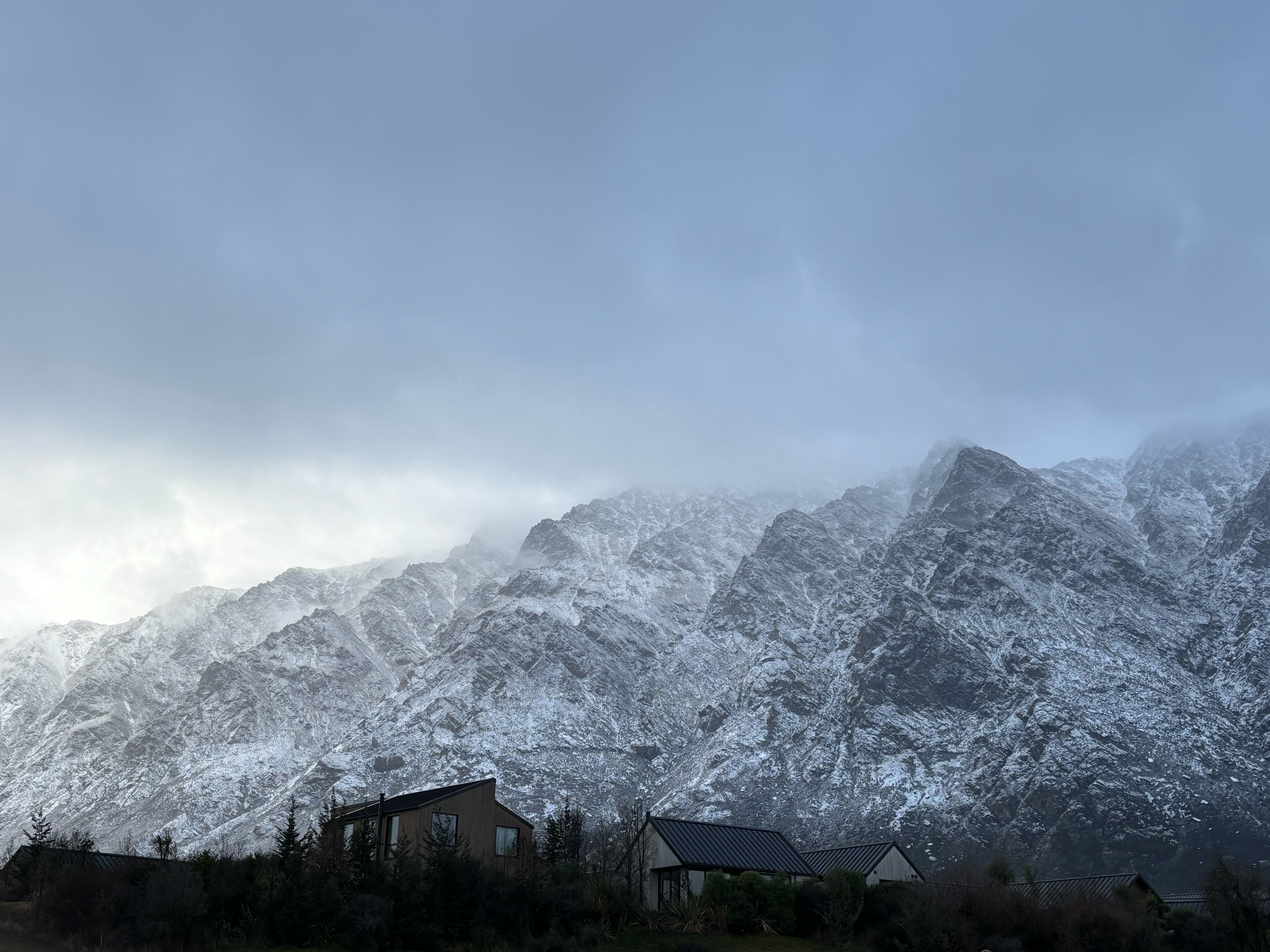
“The snowfall event really has mostly come to a close and a lot of the precipitation is easing off now,” she said.
“It will still feel quite cold, but without the precipitation, you won’t be making snow.
“Further north in the South Island, we do still have that rain continuing for a while and we’re still expecting that to be falling as snow above 400m in the morning before that starts to ease off a bit.”
Heavy snowfall closed the Crown Range Rd, stranded vehicles, shut a school and created hazardous driving conditions across parts of Central Otago yesterday.
MetService forecasts expected cold temperatures to persist over the weekend, with the possibility of severe frosts for inland areas.