Cyclone Tam live updates: Auckland councillor Shane Henderson demands answers after warnings issued hour into thunderstorms, dozens of homes flooded
MetService could’ve warned Aucklanders sooner about incoming thunderstorms that lashed the city overnight, flooding homes and businesses as up to 110mm fell in some suburbs, WeatherWatch’s Philip Duncan says.
Waitākere councillor Shane Henderson and some residents are demanding answers as to why official warnings arrived an hour into the Cyclone Tam-fuelled storm, which also cut power to 20,000 households and delivered 750 lightning strikes to the city.
Thunderstorms are “notoriously” hard to forecast, and in this case the cells had come “one after another after another”, resulting in high rainfall amounts, MetService meteorologist Alec Holden said.
But Duncan, head forecaster at the independent WeatherWatch service, believed MetService’s warnings could’ve arrived earlier – and said the lack of open data also played a part.
“They could have been putting out alerts about this earlier, because it was developing quite clearly on the lightning maps and the rain radar maps.
“At the same time, it is tricky when they are developing literally right above you. And so there is a process of delay sometimes, as you work out, ‘Is this a really big downpour that’s going to linger, or not’.”

The real, decades-old problem was the lack of open data, Duncan said.
“If we had open data that would allow councils and other government agencies, and the private sector, to all be allowed to use rain radar. Then automatic warnings would be allowed to be pushed to phones.
“And that technology has been around – at least at WeatherWatch – for the last three years, but we can’t use it here.”
STORY CONTINUES AFTER LIVE BLOG
Vector update: 'Steady progress' - some people could wait till Monday for power
Bradley Church
Vector said throughout today, crews made “steady progress” to get the lights back on for the last remaining customers still without power since ex-tropical Cyclone Tam hit the Auckland region.
The electrical storm overnight, along with fallen trees and branches, has made things more difficult than expected in some areas, Vector said.
“In some cases, faults have multiple issues which we do not discover until work starts. This can make precise restoration times challenging and changeable in some cases.
“Crews are continuing to work tonight, where it is safe to do so.”
Vector said they have advised a small number of customers that they won’t be able to get to them until tomorrow, and some repairs may take until Monday to fix.
“We know this is really frustrating - especially for those who’ve been without power for a while - and we really appreciate your patience.”
Bradley Church
Three Kings Civil Defence Centre to close at 6pm this evening
Bradley Church
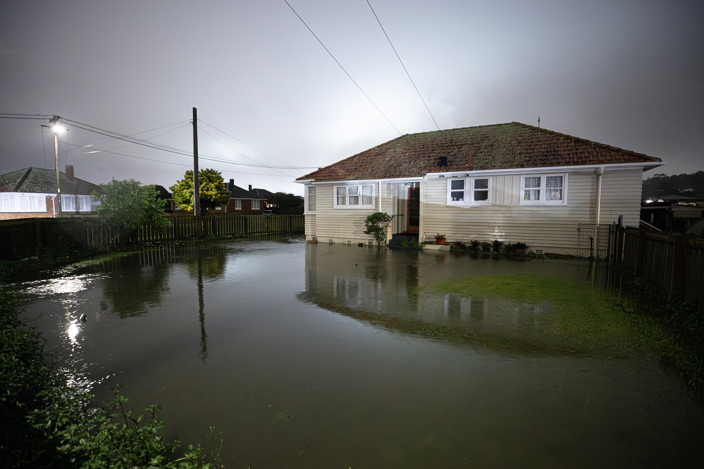
The centre opened at 4:30am at the Fickling Convention Centre, following an intense weather system overnight which caused significant flooding in parts of Auckland.
Throughout the day, the centre provided basic shelter and support for 27 people displaced by the weather event. All those who were unable to return home today have been moved into emergency accommodation.
Auckland Emergency Management is continuing to monitor the weather closely and is equipped to re-open centres overnight or tomorrow if needed.
Weather continues to disrupt Air NZ network
Bradley Church
Severe weather continues to cause disruption across Air New Zealand’s network, particularly affecting regional services in and out of Rotorua, Tauranga and Whangārei, as well as some transtasman and Pacific Island routes.
As of 4.30pm, the airline had operated more than 260 of its scheduled 388 flights, with 15 weather-related cancellations and 106 flights still scheduled for the day.
Air New Zealand chief operating officer Alex Marren said the network remained largely operational while there had been some disruption.
Four flights were diverted overnight, with flow-on effects through the day. However, an additional Wellington-Auckland service was added, allowing all disrupted customers to be rebooked, most of whom were already back in Auckland by this afternoon.
Where is ex-tropical Cyclone Tam now?
Bradley Church
MetService said ex-tropical Cyclone Tam remains in the Tasman Sea, with its rain bands continuing to sweep across New Zealand.
The system is expected to gradually shift eastward.
Power restored for thousands of Aucklanders
Bradley Church
Power has been restored to thousands of Auckland residents who lost electricity overnight in the surprise thunderstorm.
Vector said at its peak, about 20,000 homes lost power in the severe weather event connected to Cyclone Tam. However, crews working throughout the night managed to restore electricity to the majority very quickly.
Watch extended to 6pm as 'intense' weather continues
Bradley Church
The Auckland region is likely to experience more wild weather this afternoon, with MetService issuing severe thunderstorm warnings and a watch that extends until 6pm tonight.
Auckland Emergency Management general manager Adam Maggs said suburbs across the region, from Rodney to Franklin, could be impacted. He urged residents to monitor weather updates and be prepared for rapidly changing conditions.
“It has been a particularly intense few days weather-wise for our region, and that’s expected to continue throughout the afternoon,” Maggs said.
People are advised to report blocked or overflowing street drains by calling 09 301 0101 and to use the council’s "Report a Problem" page for fallen trees.
Thunderstorms set to hit parts of the North Island tomorrow
Bradley Church
MetService said people should keep an eye out for thunderstorms across parts of the North Island tomorrow, especially over northern Gisborne, Auckland, southern Northland, Waikato and Waitomo.
‘We are very lucky it stopped when it did’: Auckland beats highest hour of rain during the 2023 floods
Bradley Church
Auckland councillor Richard Hills said parts of Auckland, including the North Shore, received more than a month’s worth of rain in just over an hour.
“100mm of rain fell in the red parts [of the map], including large parts of the Shore and Central suburbs. Sadly, some homes and streets were flooded again, thinking of those affected,” Hills said.
Hills said Auckland nearly beat the records set in 2022, and beat the highest hour of rain during the 2023 floods.
Vector: 99.97% of customers have access to power again
Bradley Church
Where the heaviest downpours are at the moment
Bradley Church
Auckland's red severe thunderstorm warning extended
Bradley Church
The red severe thunderstorm warning issued over Auckland has been extended to 3pm. At 2pm, the MetService weather radar detected severe thunderstorms over West Auckland suburbs, moving southeast. They are expected to lie over Central Auckland at 2.30pm and near South Auckland's Pukekohe, Waiuku, Manukau Heads, Clarks Beach, Āwhitu, Māngere, Glenbrook, Auckland Airport and Kingseat at 3pm. The warning will be updated or lifted by 3pm.
Emergency phone alert issued by Auckland Emergency Management
Bradley Church
MetService has issued a severe thunderstorm warning for Auckland and surrounding areas, effective until 3pm today. The warning, issued at 2.09pm, affects Auckland City, Waikato, Waitākere, Franklin, Rodney and Albany.
At 2pm, MetService weather radar detected severe thunderstorms near Auckland, Henderson, Manukau Heads, Whenuapai, Piha, Greenhithe, Hobsonville, Massey, Te Atatū, Waitākere, Swanson, West Harbour, Glen Eden, Avondale, Kelston, Titirangi, and Rānui.
These thunderstorms are moving towards the south-southeast and are expected to impact Auckland, Henderson, Auckland City, Manukau Heads, Āwhitu, Ponsonby, Grey Lynn, Mt Eden, Mt Albert, Mt Roskill, Glen Eden, Avondale, Kelston, Titirangi, and Auckland Airport by 2:30pm. By 3pm, they are expected to affect Auckland, Pukekohe, Waiuku, Manukau Heads, Clarks Beach, Āwhitu, Mangere, Glenbrook, Auckland Airport and Kingseat.
The thunderstorms are anticipated to bring very heavy rain, which could cause surface and flash flooding in streams, gullies, and urban areas, making driving conditions extremely hazardous. A Severe Thunderstorm Watch remains in force for Bay of Plenty and Auckland.
The National Emergency Management Agency (Nema) advises residents to take the following precautions as storms approach:
- Take shelter indoors, away from windows.
- Avoid sheltering under trees if outside.
- Return to land if on the water.
- Move cars under cover or away from trees.
- Secure loose objects around your property.
- Ensure drains and gutters are clear.
- Be prepared to slow down or stop if driving.
During and after the storm, residents should:
- Beware of fallen trees and power lines.
- Avoid streams and drains to prevent being swept away in flash flooding.
This warning will be updated or lifted by 3pm today. Stay tuned to MetService for further updates.
Ebba Strand
'Torrential rain': Fresh red thunderstorm warning issued for Auckland
Ebba Strand
A fresh severe thunderstorm warning has been issued over Auckland, expected to bring torrential rain over the city this afternoon.
MetService says the red warning would be valid until 2.15pm and affected people in Auckland City, Waitākere, Franklin, Rodney and Albany.
"At 1.15pm, MetService weather radar detected severe thunderstorms ... these severe thunderstorms are moving towards the southeast," the forecaster said.
The thunderstorms were expected to be accompanied by "torrential rain".
"Torrential rain can cause surface and/or flash flooding about streams, gullies and urban areas, and make driving conditions extremely hazardous."
Surface flooding in Henderson
Ebba Strand
DoC said people ignored Cathedral Cove closure during severe weather
Ebba Strand
DoC operations manager Nick Kelly said that while most people respected the closure during the severe weather, some ignored the signs and barrier.
“It’s really disappointing to see people purposefully ignoring the closure and putting themselves in unnecessary danger during a major storm event when emergency services are needed elsewhere.
“On top of that, it encourages tourists without the skill and local knowledge to follow suit and put themselves at risk too. We need community members to be exemplars for respecting this place and looking out for our visitors.”
DoC will continue to monitor the site for potential risks and land movement over the coming days.
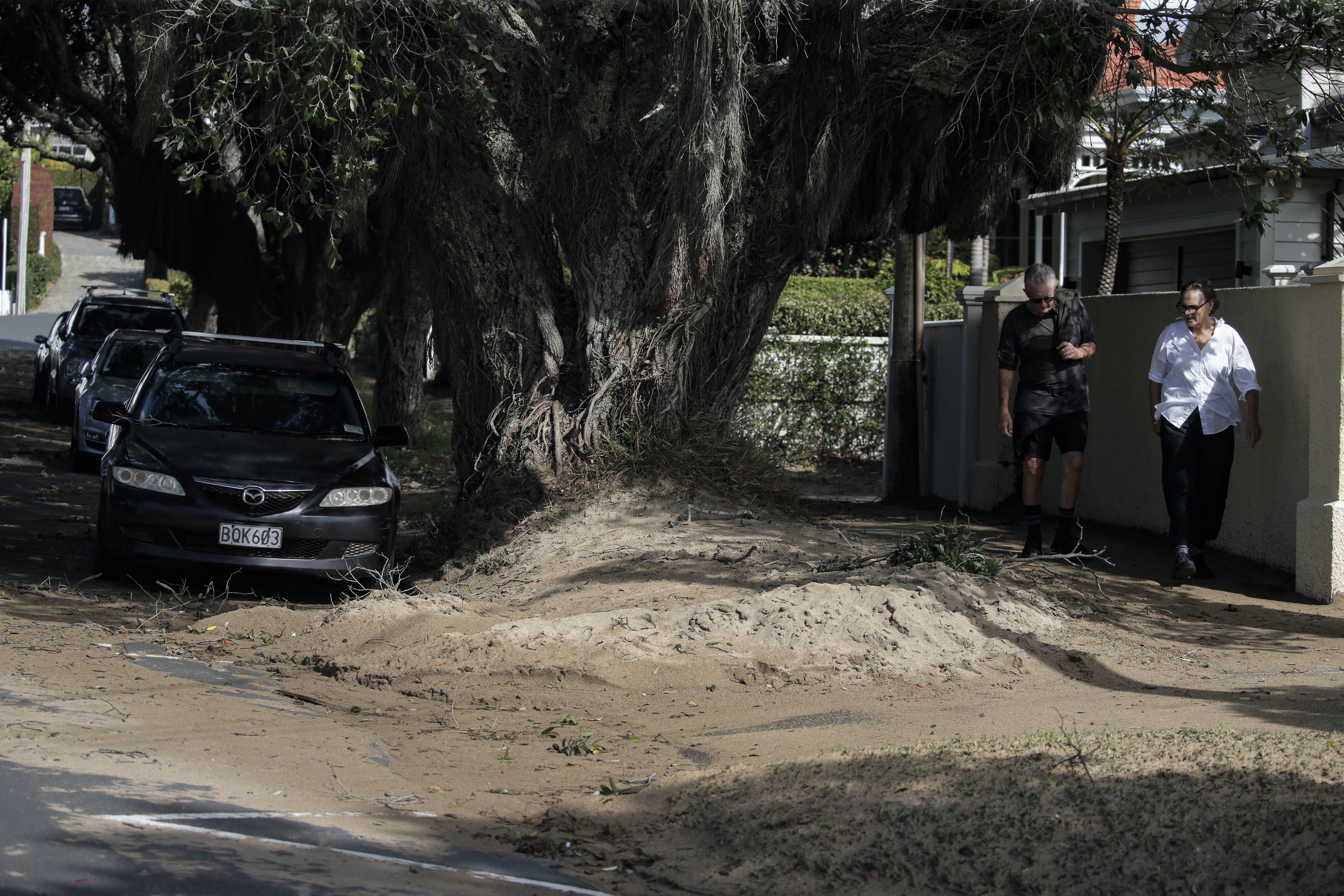
Cathedral Cove reopens – visitors urged to exercise caution
Ebba Strand
Mautohe Cathedral Cove has been reopened following its closure amid the severe weather brought by ex-tropical Cyclone Tam.
The Department of Conservation (DoC) said assessments show walking access can be reopened, but visitors need to be prepared.
DoC operations manager Nick Kelly said: “High tides and storm surges are still present on the beach. Check the weather forecast via MetService and plan your visit during low tide.
“DoC rangers have been on-site inspecting the infrastructure, which has held up well, despite a couple of trees down and some damage to signs.”
Major Coromandel state highway reopens
Ebba Strand
A major Coromandel state highway has reopened after earlier being closed by flooding.
State Highway 25 was closed this morning at Manaia after the Manaia river burst its banks and flooded the road.
However, in a update at 12.45pm, NZTA said floodwaters had now receded at Manaia and SH25 had reopened.
New World Mt Albert temporarily closed following wild weather
Ebba Strand
A Mt Albert supermarket is currently closed following a night of significant flooding.
New World Mt Albert said the heavy rain last night caused the car park to flood, with approximately 8cm of water entering the store.
Firefighters were advised that the car park flooded rapidly, going from a puddle to a pond in just 15 minutes.
At this stage, there has been a minor stock loss and some damage to the roof of the supermarket.
New World Mt Albert said their team is working towards reopening the store on Tuesday.
The supermarket told the Herald that the back flood barriers were effective, but the front barriers were less successful.
MetService could've been quicker, WeatherWatch says
Ebba Strand
MetService could’ve warned Aucklanders earlier about the series of thunderstorms that lashed the city overnight, flooding homes and businesses as up to 110mm fell in some suburbs, WeatherWatch’s Philip Duncan says.
Waitākere councillor Shane Henderson and some residents are demanding answers as to why official warnings arrived an hour into the Cyclone Tam-fuelled storm, which also cut power to 20,000 households and delivered 750 lightning strikes across the city.
Thunderstorms are “notoriously” hard to forecast, and in this case the cells had come “one after another after another”, resulting in high rainfall amounts, MetService meteorologist Alec Holden said.
But Duncan, head forecaster at the independent WeatherWatch service, believed MetService could've been quicker, and said the lack of open data also played a part.
“They could have been putting out alerts about this earlier, because it was developing quite clearly on the lightning maps and the rain radar maps.
“At the same time, it is tricky when they are developing literally right above you. And so there is a process of delay sometimes, as you work out, ‘Is this a really big downpour that’s going to linger, or not’.”
The real, decades-old problem was the lack of open data, Duncan said.
“If we had open data that would allow councils and other Government agencies, and the private sector, to all be allowed to use rain radar. Then automatic warnings would be allowed to be pushed to phones.
“And that technology has been around – at least at WeatherWatch – for the last three years, but we can’t use it here.”
MetService: More thunderstorms expected
Ebba Strand
MetService says a large part of the country is still at risk of thunderstorms today.
The weather authority has also acknowledged it will continue to look at ways to improve its monitoring systems; in a bid to warn people earlier of significant weather events.
Head of weather news, Heather Keats, said its staff had been closely monitoring and putting out weather watches and warnings accordingly over the last few days, as Cyclone Tam affected New Zealand.
But last night's thunderstorm over Auckland was rare and she stressed that it was often very difficult to predict severe thunderstorms in the same timeframe that they can in more broad-scale winds and heavy rain.
"The watch was issued at midnight. It's just unfortunate that everyone's asleep at that time, so [weren't] able to access that information."
She said more thunderstorms and thunderstorm activity are expected over a large part of the country.
As a result, MetService has updated its severe thunderstorm outlook.
Ebba Strand
Listen: What you need to know about Tam.
MetService: Expect more showers
Ebba Strand
Aucklanders can expect more showers throughout the day - and people are being advised there could still be some "bite" left from ex-cyclone Tam, MetService says.
Metereologist Alec Holden said the upper half of the North Island - including Tāmaki Makaurau - is forecast to get showers.
"We are still seeing arms extending out from the centre of Cyclone Tam passing over the upper half of the North Island - Auckland included," he said.
"At the moment, we are not expecting anything close to what we saw overnight. That is not to say that Cyclone Tam is without bite.
"There is still the potential of thunderstorms forming around that neck of the woods."
However, if any thunderstorms happened, they were most likely expected to happen west of the North Island, Holden said.
Hamish Fletcher
Stoddard Road business owner Harish Lodhia talks with Mohamed Abdul Kadir and Fadumo Ahmed from the Ethnic Sewing School that was damaged in last night's storm.
Hamish Fletcher
Stoddard Road business owner Harish Lodhia looks at the block drain that caused major flooding to his building in last night's storm.
'This is our new normal': Deputy Mayor on Auckland thunderstorms
Hamish Fletcher
Auckland Deputy Mayor Desley Simpson described the storm as "intense".
"The lightning, the thunder – it was pretty spectacular. It woke a few people up, I'm sure.
"Our thoughts are really with the Mt Roskill, Sandringham, Wesley community – particularly hard-hit; although, other parts of Auckland have got a lot of flooding as well."
Desley said the Auckland Council contact centre had received about 80 call-outs overnight and that building inspectors are now out looking at flooded properties.
Asked about the lack of warnings for Auckland residents, she said this particular weather bomb was "an alignment of the stars" at a really bad time.
She said her message to Aucklanders was that: "At this time of the year, we are going to get this crazy weather."
"This is our new normal and I think it is really important for everyone to be aware that no matter where they are, they need a plan for this intense, cyclonic heavy rainfall type of weather that we are getting..."
She said authorities always do their best to advise Aucklanders as soon as possible.
"But sometimes, it just happens discreetly. And that's what happened last night."
Thunderstorms cut power to 20,000 Auckland properties
Hamish Fletcher
Vector says 20,000 properties across Auckland lost power during the peak of the thunderstorm last night.
"Most were restored quickly, and teams worked through the night to make repairs...as it stands, 99.97% of customers have been reconnected, including those impacted by last night’s storm," Vector said in an update just before 11am.
"Today, crews are patrolling the network to check for any additional damage caused by the lightning strikes."
Hamish Fletcher
Cars stranded in floodwaters overnight in Mt Roskill
'No advice and no real guidance': City leader demands answers
Hamish Fletcher
A city councillor wants to know why warnings of the severe thunderstorms that flooded homes, cut power and rattled residents in Auckland overnight didn’t come earlier.
It was an hour into the weather event before official warnings arrived, Waitākere councillor Shane Henderson said of the storm which left streets swamped, cars stranded and homes surrounded by water as up to 110mm of rain began falling just after midnight.
Fire and Emergency responded to 175 callouts during the storm, which was accompanied by up to 750 lightning strikes and thunder – shaking sleeping Aucklanders’ homes, as well as their nerves.“I want to know why warnings weren’t issued a bit earlier”, Henderson said.
“These things are notoriously hard to predict, but I’d just say that we err on the side of caution, and maybe MetService needs to have a look at some of the trigger points, because it was certainly pretty gnarly well before the warnings came out.”
Residents were instead left with a “vacuum of information, no advice and no real guidance” on what was to come, a situation that reminded him and others of similar failings during the deadly and damaging Auckland Anniversary Weekend floods two years ago.
“People need to be assured that we've got those systems in place so that we know what's going on.”
'You could hear bubbles': Sandringham resident says water was coming from the ground
Ebba Strand
Sandringham resident Paul Mitchell found his yard had become a lake overnight.
"I just looked out the window and was like, 'oh, we've got a lake in front of the house'," said Paul Mitchell, who rents the flooded property on Lambeth Road.
The 57-year-old said he had to wade through water past his calves as he raced to the garage to save his power tools.
"The funny thing was that the water was coming from the ground. You could hear bubbles," he said.
He recalled seeing a "few things floating around" but managed to save two lawn mowers and other tools.
"It was quite intense. Didn't expect it to flood. The water came up really fast."
New weather warnings from Metservice
Hamish Fletcher
MetService has just issued some fresh weather warnings outside of Auckland.
"Cyclone Tam lies west of New Zealand and is expected to slowly move east across the upper South Island during Sunday and Monday, while gradually weakening. Associated troughs move eastwards across the country through into Monday, bringing heavy rain to parts of New Zealand," the warning said.
There are heavy rain warnings for Tasman northwest of Motueka and Taranaki Mounga.
Hamish Fletcher
Mt Roskill MP Carlos Cheung was driving around this morning to check on people - and stopped by to see those on Denny Ave.
Many of those residents were badly affected during the Auckland Anniversary flooding weather event in 2023.
"Two years ago, before I became a politician, I was a volunteer trying to help with the cleaning - and this time, it's very lucky," he said, acknowledging that it was not as bad as it was for locals two years ago.
He said as a result of that event, storm water systems had been upgraded in the area.
However, because of the creek that ran behind the street, residents were still affected when heavy rain fell.
"Most of the houses built here, they weren't built high [enough]."
Cheung had also visited the local emergency centre facility that had been opened in the early hours of this morning, to help residents affected.
One person was there at the moment, he said, as his home had been completely flooded.
Seven flights diverted away from Auckland Airport overnight
Vera Alves
During the storm and lightening overnight, seven flights diverted away from Auckland Airport for safety reasons. The weather may continue to impact flight schedules so Auckland Airport advises travellers to keep a close watch for updates from their airline if flying today.
Vera Alves
Aucklanders share stories after thunderstorms wallop city
Vera Alves
Power outages, shaking houses, blaring car alarms, terrified pets and baked beans at 1am – it was a wild night for thousands as thunder and lightning crashed and flashed across New Zealand’s biggest city early this morning.
Read the full story below.
Vera Alves
Vera Alves
The Mt Albert New World supermarket sustained damages to its roof.
Auckland council carrying out building inspections in affected areas
Vera Alves
Dozens of Aucklanders were hit by flooding inside their homes as authorities scrambled to respond to 175 call-outs, Auckland Emergency Management says.
Fire and Emergency responded to more than 175 call-outs and the council’s contact centre received more than 80 calls about stormwater, trees and surface flooding
"Dozens of residents will be mopping out lower floors and parts of their property today," Auckland Emergency Management General Manager Adam Maggs said.
Maggs said the flooding was caused by an "intense thunderstorm band that developed intensity quickly".
“These weather systems can deliver sharp bursts of high intensity rain; can arrive without much warning; and, depending on where they land, they can cause different impacts.
“Exactly when, where and how much [rain] is also extremely unpredictable.
“Last night all these elements of a storm came together at the same time – residents of Sandringham and Mt Roskill fared the worst with more than 100mm of rain recorded during the thunderstorm,” he said.
“Surface flooding around the roading network has started to dissipate,” Maggs said. “The council’s building inspectors will be out and about today checking houses in affected areas and carrying out rapid building inspections.”
“If you’re cleaning up this morning, take extreme care and remember that floodwater should always be treated as contaminated – you don’t know what might be in the water or what debris might’ve been collected.
“If your property is damaged, take photos for your insurer before you start clearing up. If renting, contact your landlord, and if you think your home needs a rapid building assessment, phone the council on 09 301 0101,” says Maggs.
If your life or property is at risk, phone 111.
Vera Alves
A Fire and Emergency spokesperson says there's been around three more weather related calls since 6am.
One a downed power line, one a downed tree and another for flooding related.
International flights diverted following thunderstorms
Vera Alves
Air New Zealand Chief Operating Officer, Alex Marren said four international flights had been diverted to Wellington due to heavy rain, severe thunderstorms, and lightning overnight in Auckland.
“Our airport teams in Wellington worked through the night and into this morning to rebook customers onto alternative flights. To assist with this, we’re also operating an additional service between Wellington and Auckland to help get diverted customers back to where they need to be.”
He said some international services scheduled for today have had to be delayed due to last night’s disruptions, as aircraft and crew need to be repositioned to Auckland.
“We’d like to thank the customers who were diverted last night, as well as those impacted today, for their patience and understanding.”
He said the weather continues to affect multiple airports today, and customers travelling were encouraged to check the Air New Zealand app or the arrivals and departures page online for the latest updates.
“We also recommend customers ensure their contact details are up to date in their bookings so we can reach them with any important updates.”
Vera Alves
Mt Roskill Civil Defence Emergency Shelter set up overnight.
'No one was prepared': Auckland resident says water was 'above the knee' on his road
Vera Alves
Mt Roskill resident Mohammad Hussain was awoken at 2am from “heavy noise”.
“All of a sudden I noticed like heavy wind and heavy rain”.
He said his wife was “very scared”.
The 55-year-old said his socks and shoes became soaked when he stepped out in front of his property on May Road.
But when he went to the road, the water was “above the knee”.
By the time Hussain left for work at 2.30am he said the water had receded.
He said his property hasn’t suffered damage but he noticed his neighbour’s house had.
“No one was prepared. Everyone was sleeping."
On the lack of warning from Metservice, Hussain said “it’s not their fault” as he believes it was an unpredictable event.
Vera Alves
Flooding in the Auckland suburb of Sandringham.
750 lightning strikes over Auckland
Vera Alves
There were 750 lightning strikes over Auckland during the thunderstorms that hit the city early this morning, MetService says.
Brand new walkway bridge destroyed by storm water
Vera Alves
New Oakley Creek bridge at Cradock St had opened just a month ago.
Neilson St off-ramp re-opens
Vera Alves
Auckland residents begin cleaning up after thunderstorm
Vera Alves
Steven Schaumkel was up most of the night as water engulfed the land around his home in Sandringham.
He was cleaning up in still-ankle deep water when he spoke to the Herald at his O'Donnell Ave property shortly before 8am.
Schaumkel, who was been flooded on multiple occasions over the last few years, said he tried to get his car out, but the battery had died.
Auckland council asks those with flooding or water damage to report it
Vera Alves
Auckland Emergency Management General Manager Adam Maggs told Newstalk ZB a few areas of the city had been “hit with quite a lot of water” as the thunderstorm cells passed through.
“Specifically Mt Roskill and Sandringham, so that caused a lot of surface flooding and we know there’s a couple of properties that may have some flooding inside the house, so we’re looking at having an inspection of those properties, and seeing what's needed there to get them resolved.”
They were finding it hard to get an exact number of houses affected, because they relied on people “calling those in”, either through Fire and Emergency, the council on (09) 301 0101 or 111 if life or property was at risk, Maggs said.
“At the moment we've [got] single digit numbers [affected], but we actually don't know if there's more there.
“That's why we're very keen for people - if their house is flooded or they've got some water damage - to call it into the council.”
Flooding around public drains should also be reported to the council - with Healthy Waters’ teams out this morning clearing drains - and if trees are down people should report those via the council’s website www.aucklandcouncil.govt.nz.
“That's probably the best way for our teams to be able to work on the issues.”
The council’s contact centre received around 84 calls between midnight and 4.30am, about half storm-related and linked to incidents Fire and Emergency were responding to, Maggs said.
Fire and Emergency received 175 calls, both flooding related and situations where alarms had been triggered by the weather, he said.
“[It was] quite a high number of calls that reduced down very quickly from about 3am, and we reduced down to a virtually normal levels. So, Fire and Emergency are back to business as usual, and have addressed all of those issues.”
A Civil Defence Centre was set up at The Fickling Centre on 546 Mount Albert Rd in Three Kings at 4:30am, Maggs said.
“We haven't had anyone come through … we're hopeful that's an indication that perhaps the damage from this thunderstorm system is less than we thought it might be.”
Vera Alves
Police stop traffic on Onehunga Harbour Rd due to flooding:
Vera Alves
Vera Alves
Ebba Strand
More rain is expected in Auckland today
Ebba Strand
Cyclone Tam still had “the potential of bite” in it for Auckland today, MetService meteorologist Alec Holden said.
“More rain is expected in Auckland this morning. We are continuing to see more bands of showers extending from the centre of Cyclone Tam that are looking to impact Auckland. However, thankfully it does look to be a more easing trend today as Cyclone Tam gradually is losing steam.
“That’s not to say Cyclone Tam is not without the potential of bite still in it so we advise you keep up to date with all of our forecasts and watches and warnings on the MetService website.
“There is definitely the potential for more storms in what would likely be the western half of Auckland, though we are not concrete on that right now.”
A new run of weather models was expected soon, and the severe weather team would be “very seriously considering” those, Holden said.
MetService responds to 'no warnings'
Ebba Strand
An “arm of rain” that stretched out from the centre of Cyclone Tam was responsible for intense downpours and thunderstorms across Auckland overnight, MetService meteorologist Alec Holden said.
There had been very heavy rainfall across swathes of the region, especially from areas between Mt Roskill and Albany.
“In those areas worst affected we’ve seen 55mm to 110mm fall overnight, with districts around them catching between 30mm to 50mm. This is quite a significant amount of rainfall and it earned itself a severe thunderstorm watch over that period.
“What happened exactly is we saw an arm of rain stretched out from the centre of Cyclone Tam and train over those worst affected areas, meaning we saw thunderstorm after thunderstorm after thunderstorm after thunderstorm just pound those same areas over and over again, resulting in those high totals.”
Asked why there was no warning before the weather system arrived, Holden briefly paused before saying, “That is a very good question”.
“In this case, thunderstorms are historically and notoriously difficult to forecast. In this case, the worst of it came from the fact that none of those individual thunderstorm cells were particularly notable, but it was the unfortunate incident of them coming one after another after another … to result in such high rainfall amounts.”
More than 170 weather-related calls received
Ebba Strand
Fire and Emergency NZ said they received more than 170 weather-related calls across Auckland at the peak of the storm.
'No warning at all': Aucklanders comparing situation to Anniversary floods
Ebba Strand
A North Shore resident said it was the most severe storm she ever experienced on the Shore by far.
“House shaking, no power, crying and scared 5-year-old and no warning at all.”
Another person said: “Insanely loud sound of the thunder and lightening over Bayview.”
Many Aucklanders are now asking about the apparent lack of warning and comparing the situation to the devastating Anniversary Weekends floods.
The Herald has spoken to several upset residents, saying that Metservice were updating their site as it was happening and issued a warning after the flooding started - no warning at all, and the drains were all blocked from the last storm.
Severe thunderstorm watch
Ebba Strand
MetService issued a severe thunderstorm watch around midnight, saying a slow-moving line of thunderstorms lies over the Auckland area.
"Some places in Auckland, mainly east of a line from Kaukapakapa to Waiuku (not this includes most of the urban areas of Waitakere, North Shore, Auckland Central and South Auckland) may experience downpours of 25 to 30 mm per hour and total accumulations of 50 to 60 mm over 3 to 4 hours."
Ebba Strand
Lightning struck the Sky Tower during the storm that hit Auckland overnight Photo / Vishal Umashankar
Ebba Strand
Mt Roskill resident: 'Pretty crazy'
Ebba Strand
A Potter Ave resident in Mt Roskill told the Herald just before 2am the flooding was “pretty crazy”.
“[There was] just a bit of heavy rain and and all of a sudden it's all flooding now.[My property] it’s all flooded … nearly up on the driveway …it's nearly touching my knee. The weather stopped, but it seems like [the water’s] still rising.”
He understood there’d been flooding in the street before, but had only moved into his house last month.
“So this is my first time experiencing this. Yeah, it’s pretty crazy.”
Ebba Strand
Traffic management has closed a section of Sandringham Road Extension overnight as floodwaters entered properties and flooded the street, a Herald photographer said just before 6.30am.
Ebba Strand
A man climbed out of his car window after becoming trapped by floodwaters on Onehunga Harbour Rd early this morning.
Speaking exclusively to NZ Herald, the driver said the water rose so high that it flooded his engine.
"The starter motor is absolutely stuffed now and won't start at all. It's quite deep, at least around one metre. I don't have insurance, so yeah, that's that - pretty she it's gone now I had all my tools in it, so yeah, those are all pretty gone," says Paul Davies.
"Fire trucks arrived at the scene to help me, but I managed to free myself from the floodwaters before they arrived. I tried the door, but I was trapped by water, so I climbed out the window to safety."
"I'm quite good for my age to be doing this. I've just never experienced anything like this before. It's just bad, everything is just flooded, again, just no warning. I thought It was just a small puddle when I entered."
Floodwaters in Mt Roskill
Lane Nichols
Residents walk through floodwaters on Denny Ave in Mt Roskill.
A car navigates floodwaters in Auckland
Lane Nichols
Floodwaters in Mt Roskill
Lane Nichols
Home surrounded by floodwaters at the intersection of Potter Ave andParkinson Ave, Mt Roskill.
Intense rain sparked flooding across the city
Lane Nichols
Surface flooding in Auckland
Lane Nichols
Flooding in Auckland overnight
Lane Nichols
Lane Nichols
More information can be found at aem.govt.nz
Updates will also be on the council's emergency management Facebook and X social channels: facebook.com/aklcdem@AucklandCDEM
Intense weather system hits Auckland, significant flooding
Lane Nichols
An “intense weather system” that crossed Auckland just after midnight has caused significant flooding across the city, Auckland Council Emergency Management says.
A Civil Defence Centre was opened at the Fickling Convention Centre at 546 Mt Albert Rd in Three Kings at 4.30am.
“If you need to leave your home due to flooding, and are unable to shelter with friends or family, please carefully make your way to this centre," Auckland Council Emergency Management said.
“The centre will offer basic shelter and support for those displaced by this weather event.”
Bring with you:
- Essential items like medication and baby needs
- Warm clothing and footwear
- Food for any special dietary requirements.
“If pets can’t be safely left at home, you may bring them with you but they may need to stay in the car.”
Ex-tropical Cyclone Tam live coverage
Lane Nichols
Good morning and welcome to our live coverage of ex-tropical Cyclone Tam.
STORY CONTINUES
Henderson said residents were left with a “vacuum of information, no advice and no real guidance” on what was to come during the storm.
“I want to know why warnings weren’t issued a bit earlier … these things are notoriously hard to predict, but I’d just say that we err on the side of caution, and maybe MetService needs to have a look at some of the trigger points, because it was certainly pretty gnarly well before the warnings came out.”
Dozens of Aucklanders were hit by flooding inside their homes as authorities scrambled to respond to 175 callouts during the wild weather, with up to 110mm of rain falling overnight.
Henderson and many others had noted the similarity with the deadly and damaging Auckland Anniversary weekend floods two years ago, where there were failings in how quickly and appropriately residents were warned of the coming danger.
“We’re afraid of that kind of situation repeating, and people need to be assured that we’ve got those systems in place so that we know what’s going on.”
Asked why there was no warning before the weather system arrived, MetService meteorologist Alec Holden earlier told NZME:
“That is a very good question. Thunderstorms are historically and notoriously difficult to forecast.
“In this case the worst of it came from the fact that none of those individual thunderstorm cells were particularly notable, but it was the unfortunate incident of them coming one after another after another … to result in such high rainfall amounts.”

Early this morning streets were swamped, motorists stranded, homes surrounded by water and power to up to 20,000 households was knocked out during the night.
A North Shore resident said it was the most severe storm she had experienced on the Shore by far.
“House shaking, no power, crying and scared 5-year-old and no warning at all.”
Another person said: “Insanely loud sound of the thunder and lightning over Bayview.”
An “arm of rain” that stretched out from the centre of Cyclone Tam was responsible for the intense downpours and thunderstorms, said Holden, the meteorologist.
Areas between Mt Roskill and Albany appeared to have been worst hit, with some areas recording between 55mm to 110mm overnight rainfall.
A Herald photographer said the worst-affected areas appeared to be around Mt Roskill and Sandringham, including Stoddard and O’Donnell Aves and Sandringham Rd.
“There was no warning at all. Residents are absolutely p***ed.”
Fire and Emergency NZ said they received more than 170 weather-related calls across Auckland at the peak of the storm.
A person staying at the Cordis in Auckland’s CBD said the thunder appeared to have set off the fire alarm and hundreds of people were in the the street.
Storm hangs on this Easter weekend
After severe rain and wind lashed the North Island, ex-tropical Cyclone Tam continues to hang on this Easter weekend, directing unstable fronts and troughs onto the northern South Island.
Meteorologists continue to keep an eye on a second weather system looming for New Zealand next week.
Ex-tropical Cyclone Tam currently lies west of New Zealand and will slowly weaken over the Easter weekend.
MetService meteorologist Samkelo Magwala said heavy falls are still on the cards for much of the country despite the weather overall “improving significantly”.
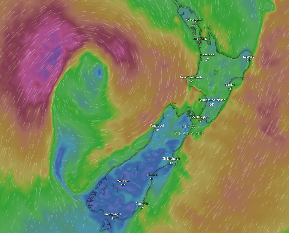
Tasman, Nelson and northern Marlborough should expect some heavy falls today, Magwala said.
Auckland will likely receive scattered rain that could turn heavy, with possible thunderstorms before midday also likely.
“Associated fronts move southwards over the country through into Saturday, bringing heavy rain to parts of the North Island and upper South Island.
“Large waves affecting eastern coastlines of the upper North Island are expected to gradually ease,” said MetService.

The system has also brought a wave of hot and humid air with potential for “record-breaking April temperatures” across the country.
Magwala told the Herald Wellington is in for an abnormal high of 25C today.
MetService said daytime highs today and Sunday may even reach the mid to high 20s elsewhere in the eastern and lower North Island.
Niwa meteorologist Seth Carrier told the Herald Tam’s remnants would slowly move away from New Zealand, and it might take until Tuesday or Wednesday for all the associated rainfall to end.
Heavy Rain Warning – Orange
A number of regions still remain under heavy rain warnings today, where the risk of streams and rivers rising also remains.
MetService says regions under these warnings could experience surface flooding, slips, and difficult driving conditions today.
How likely is another storm next week?
The new weather system appeared to be tracking towards New Zealand from the northeast on Monday and Tuesday.
Magwala said that at this early stage, there is a “low potential” for another tropical cyclone to develop.
It is still too early to determine if it would amount to anything significant, Magwala said.
Sign up to The Daily H, a free newsletter curated by our editors and delivered straight to your inbox every weekday.